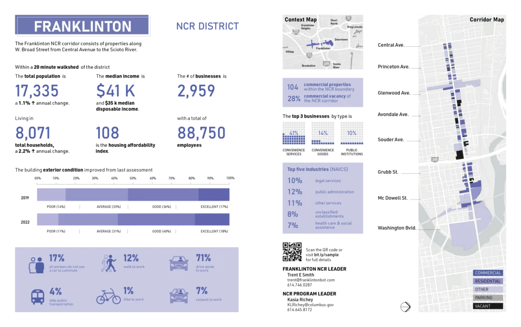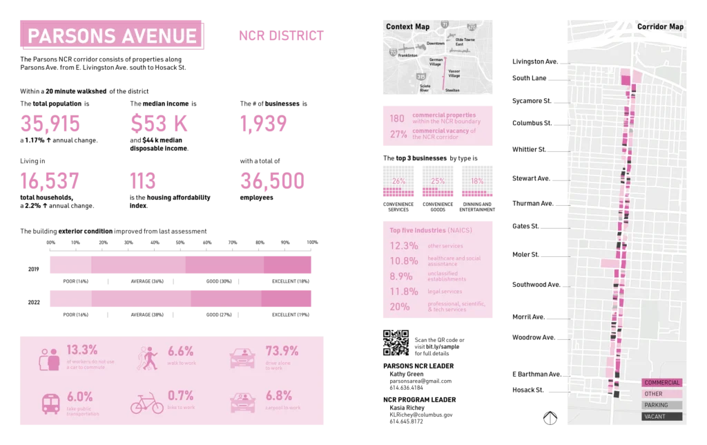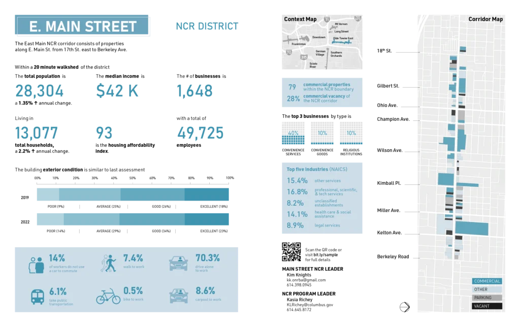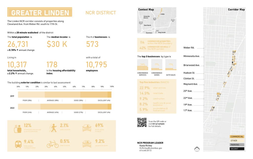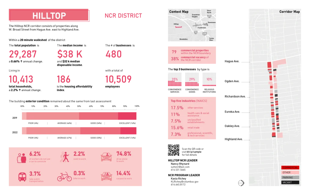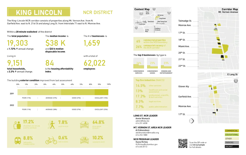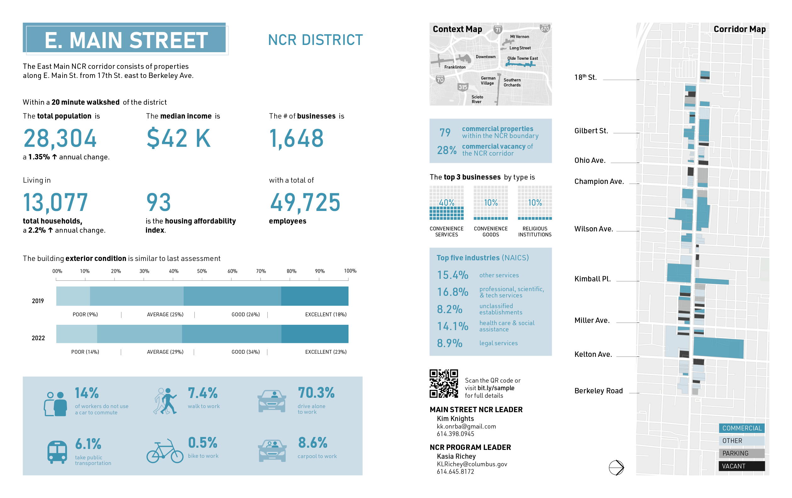
This project involved a series of data-driven analyses of six Neighborhood Commercial Revitalization (NCR) corridors in Columbus – East Main, Franklinton, Hilltop, King-Lincoln, Linden, and Parsons Avenue. The work supported the City of Columbus by translating complex economic, spatial, and demographic data into clear visual narratives for planners, community leaders, and local stakeholders .
Using a consistent analytical framework, I examined commercial vacancy, building conditions, land use, business types, mobility patterns, and neighborhood context within a 20-minute walkshed for each corridor. This approach allowed for meaningful comparison across neighborhoods while still responding to local conditions and histories.
The analyses surfaced key differences in corridor performance—ranging from reinvestment pressures in Franklinton and King–Lincoln to persistent vacancy and auto-oriented patterns in Linden and Hilltop, and higher commercial activity along Parsons Avenue. These insights helped identify where targeted economic development, design interventions, or policy support could have the greatest impact.